What's HeyWhatsThat?
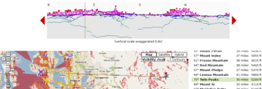
You're on top of a mountain or pulled over at a scenic overlook. You see distant summits. What are they? HeyWhatsThat provides panoramic sketches and the names of visible peaks. You can browse panoramas that someone else has requested and generate your own. And you can do it via web, email and phone. Our current offerings:
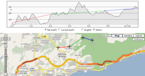 The Path Profiler allows you to create a path and generate its elevation profile. (FAQ)
  We've written Mapplets for elevation contours, path profiles, and sea level rise. (FAQ)
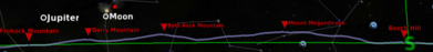
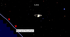 And the Cosmic Visibility page does the same inside your web browser, and gives you new insight into the Moon's phases and the Earth's seasons and what you can see on Mars. (FAQ)
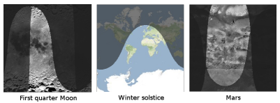
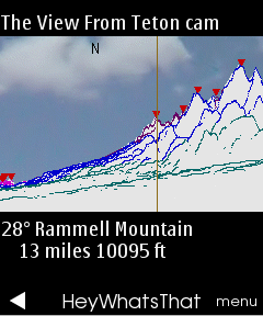 We've got a prototype running on GPS-enabled mobile phones thanks to uLocate's WHERE technology, and it's a semifinalist in the NAVTEQ Global LBS Challenge.
www.heywhatsthat.com
This entry was posted
on 17:37
.

